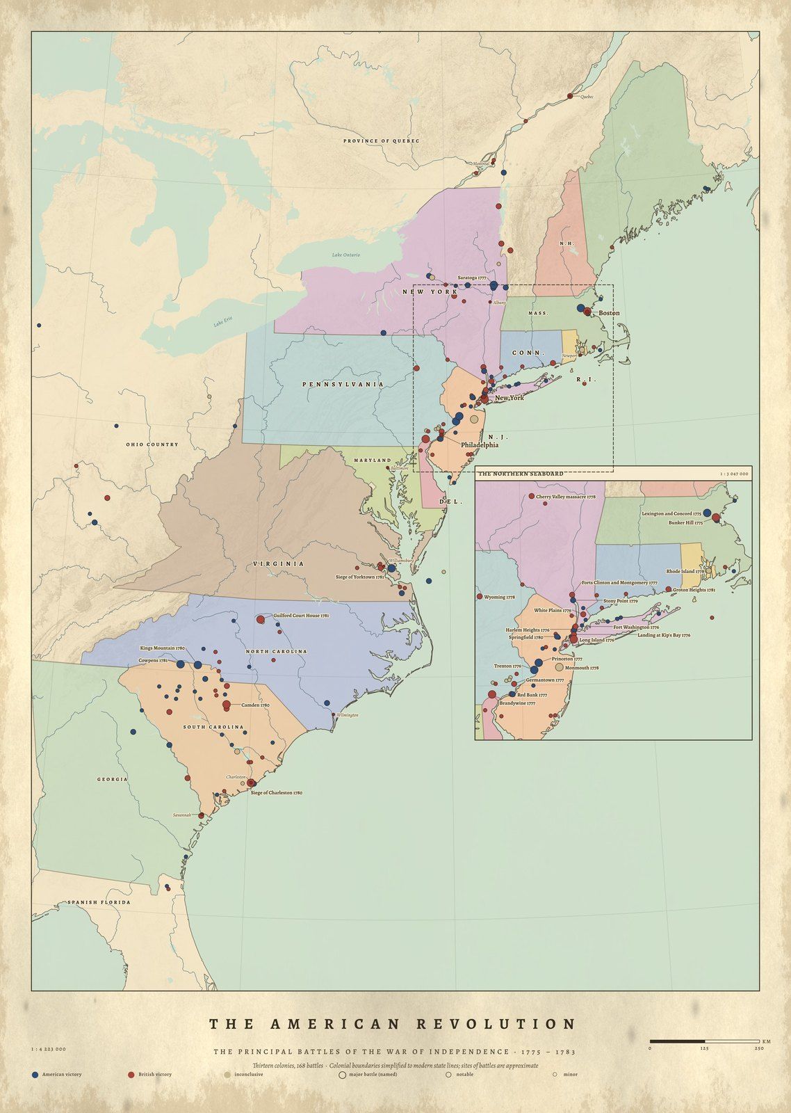
The battles of the War of Independence, 1775–1783, placed across the thirteen colonies.
1 map · 0 available now
No. 10The American Revolution1775–1783 · Coming soon
About this map
A map of the Revolutionary War's battles
The American Revolution places the battles of the War of Independence across the thirteen colonies, with dates and results and an inset of the crowded northern seaboard. Coordinates come from Wikidata and the relief from satellite elevation.
Questions about these maps
Are these reproductions of old maps?+−
No. Each map is drawn new from research data (road and trail surveys, battle records, gazetteers and satellite elevation) and engraved in the manner of an 1889 atlas. Nothing is copied from an old map, and nothing on it is invented.
How are the prints made and shipped?+−
Each print is made to order by our partner Gelato at a printer near the delivery address, in the United States or in Europe, on archival matte paper. Framed prints arrive ready to hang. Production takes 2–5 business days; the delivery estimate for your address is shown at checkout.
Printed near you Made to order by our partner Gelato in the US and Europe
Archival paper Museum-quality matte stock, framed or unframed
Sources credited Every dataset and licence named with the print
Drawn from data Not AI-generated maps, not reproductions