How Long Was the Oregon Trail? The Trails West in Miles
About 2,000 miles (3,221 km) from Independence to Oregon City, measured on the National Park Service's mapped trail. Plus six other trails west, in miles and km.
By Thomas van der Bruggen, Cartouche Maps · Published
Measured along the trail line the National Park Service publishes, the main route of the Oregon Trail, from Independence, Missouri, to Oregon City, is about 2,000 miles (3,221 km) long. Its mapped cutoffs and alternate routes add another 253 miles (408 km).
We measured those lines to draw The Trails West, so here is the same measurement for all seven trails on the map.
Where the number comes from
The National Park Service’s National Trails Office publishes the congressionally designated route of each National Historic Trail as a GIS line. We downloaded seven of them in October 2026 and measured every segment on the WGS84 ellipsoid. Our two independent length calculations agree to within 0.43%.
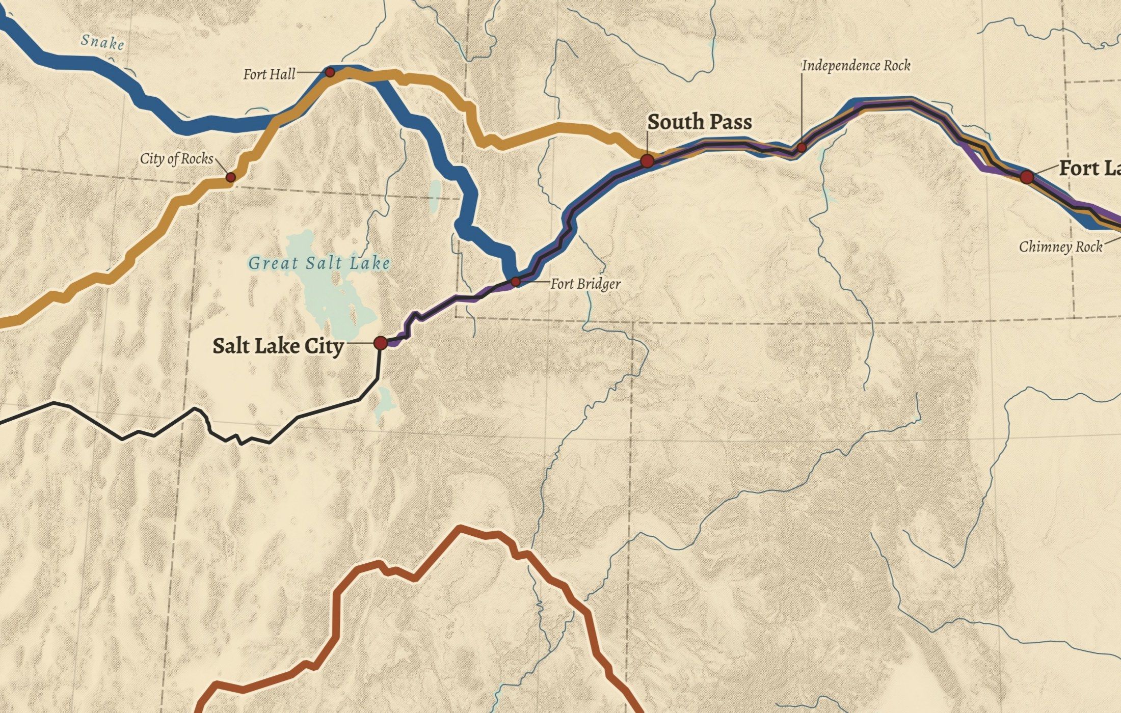
There is one catch, and it matters. For most trails the Park Service publishes the whole trail as a single tangle of lines: the main road, every cutoff and every alternate together, with nothing marking which is which. The split into “main” and “alternate” below is ours, not the Park Service’s. For each trail we took the shortest path through the network from the classic starting point to the classic end. Where the shortest path would follow a cutoff, we routed it through fixed waypoints instead:
- Oregon: Independence to Oregon City, shortest path.
- California: Independence, Fort Hall, City of Rocks, Humboldt Sink, Truckee, Sutter’s Fort.
- Mormon Pioneer: Nauvoo to Salt Lake City, shortest path.
- Pony Express: St. Joseph, Salt Lake City, Carson City, Sacramento.
- Old Spanish: Santa Fe, the Green River crossing, Las Vegas springs, Los Angeles.
- Santa Fe: the derived main path follows the Cimarron Route, so the Mountain Route is counted as an alternate, although both were historic main routes.
- Lewis and Clark: the source data does mark this one. “Main” is the outbound journey; the return-journey splits are alternates, and the 1803 Ohio River leg from Pittsburgh is listed separately.
A different choice of endpoints or cutoffs would give a different main-route figure. Treat the totals as measurements of a mapped line, not as the distance any one wagon traveled.
The trails west, measured
| Trail | Years on our map | Main route | Alternates and cutoffs | All mapped lines |
|---|---|---|---|---|
| Oregon | 1841–1869 | 2,002 mi (3,221 km) | 253 mi (408 km) | 2,255 mi (3,629 km) |
| California | 1841–1869 | 2,002 mi (3,222 km) | 5,946 mi (9,569 km) | 7,948 mi (12,791 km) |
| Mormon Pioneer | 1846–1869 | 1,340 mi (2,156 km) | 38 mi (61 km) | 1,377 mi (2,217 km) |
| Pony Express | 1860–1861 | 1,787 mi (2,877 km) | 218 mi (351 km) | 2,006 mi (3,228 km) |
| Santa Fe | 1821–1880 | 867 mi (1,395 km) | 1,064 mi (1,713 km) | 1,931 mi (3,108 km) |
| Old Spanish | 1829–1848 | 1,094 mi (1,760 km) | 1,658 mi (2,669 km) | 2,752 mi (4,429 km) |
| Lewis and Clark | 1804–1806 | 3,574 mi (5,751 km) | 1,558 mi (2,508 km) | 6,304 mi (10,146 km) |
The Lewis and Clark total includes 1,172 miles (1,887 km) for the 1803 Ohio River leg. The years are the periods of main use we chose for the poster; they are our editorial choice, not Park Service attributes.
Three things the table shows
The Oregon and California trails start as one road. In the Park Service data the California Trail shares its line with the Oregon Trail from Independence to Fort Hall, and the Pony Express, Oregon, California and Mormon lines also run together along the Platte. That is why the two main routes come out almost equal, and why the trail lengths should not be added up.
The California Trail is mostly alternates. About three quarters of its mapped length (5,946 of 7,948 miles) lies off our derived main route. The Park Service itself says the California National Historic Trail “is over 5,000 miles long”. Our figure for every mapped line is higher. We have not reconciled the two; the Park Service may count its routes differently from a straight sum of segments.
The Pony Express figure lines up with the Park Service. Our main route, St. Joseph to Sacramento, measures 1,787 miles. The Park Service describes the ride as “more than 1,800 miles in 10 days” from St. Joseph to Sacramento.
For Lewis and Clark the Park Service gives “nearly 4,900 miles”. Our outbound main route is 3,574 miles and all mapped lines together are 6,304, so the Park Service figure is a different count from ours. We quote it as published.
How accurate is a 1:100,000 trail line?
Six of the seven layers are published at 1:100,000 scale; the Old Spanish Trail is at 1:500,000. That is detailed enough for a wall map, but a line at that scale is a generalization of the route, so read the lengths as rounded figures. The Park Service also notes that a designated historic trail is not a developed hiking trail: it marks where the historic route ran, not a path you can follow today.
See it on the wall
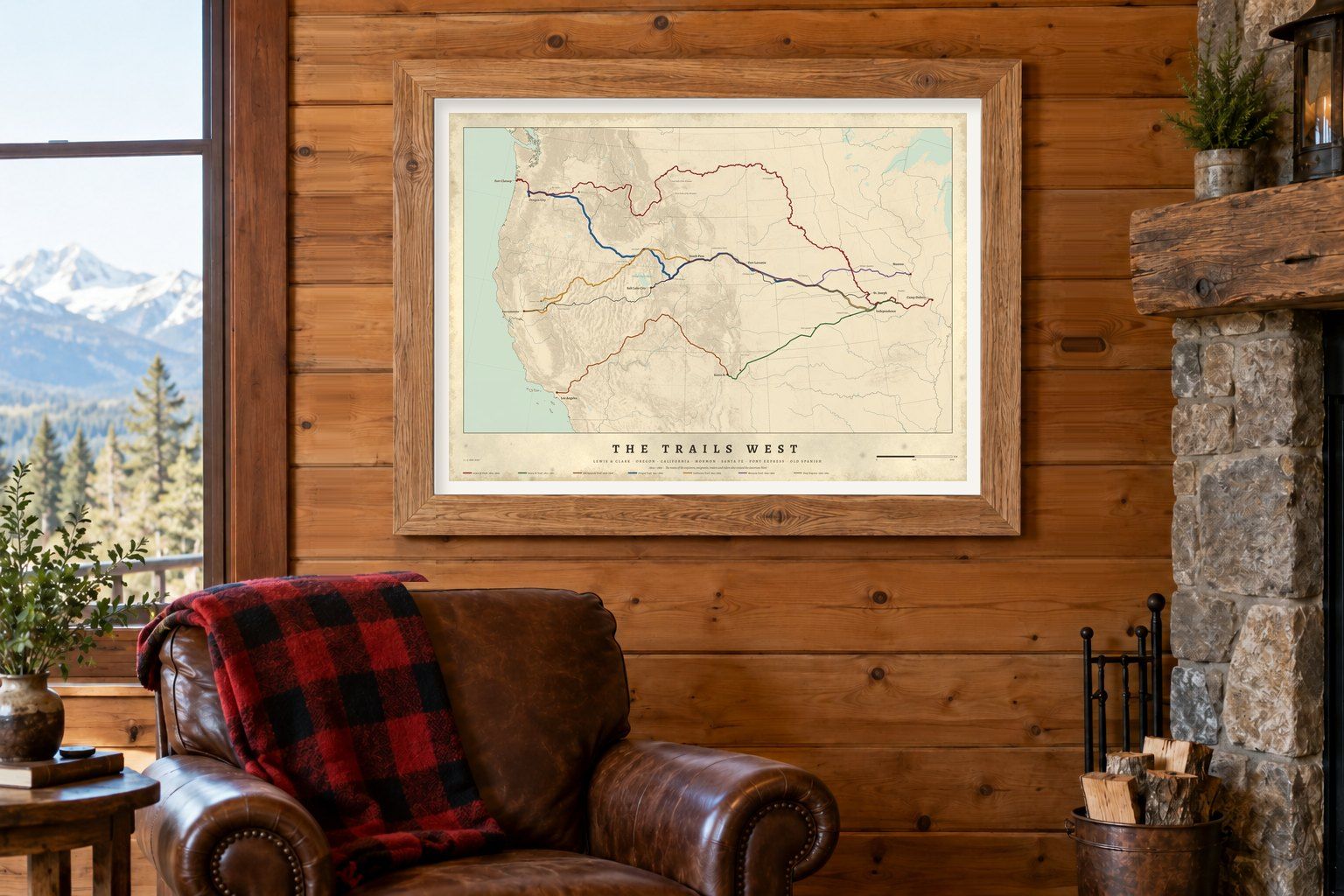
The Trails West draws all seven trails on one relief map of the West, with landmarks such as Fort Laramie, South Pass and Sutter’s Fort.
Trail lines: National Park Service, National Trails Office (public domain), downloaded 2026-10-06. Lengths measured by us on the WGS84 ellipsoid; the main/alternate split is our own derivation. Miles converted at 1 mile = 1.609344 km.
On the wall
The American West